
Pohewa Pae Tawhiti (Visualising Horizons) is a facilitated process for land governors to explore land use options that may be suitable for their land.
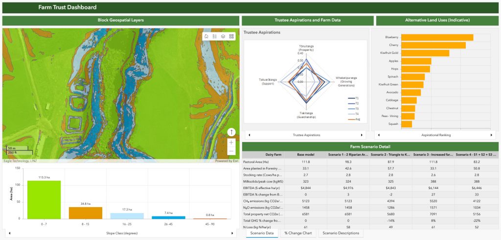
The PPT process works with land governors to combine their whakaarotau (priorities) and pohewa (their vision for the land) with the land block’s geospatial layers and biophysical data (current and modelled scenarios) along with alternative land use information so they can discuss potential options for land use change on their whenua or farm utilising the most current data.
The process can be used by land governors such as trustees, board members, committees of management and/or farmers who are working collectively around land-use decision making.
For more information, contact Pohewa Pae Tawhiti at admin@ppt.org.nz.
Contact: admin@ppt.org.nz